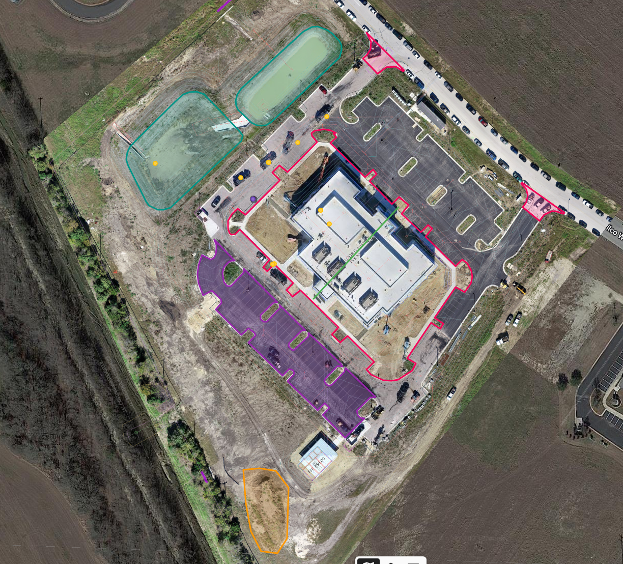
At SkyHawk Drone Solutions, we specialize in providing high-quality drone inspections in the form of videos and images that are useful for a variety of industries and applications. Our services are particularly valuable to real estate agents, roof inspectors, and construction sites as they allow for a detailed visual inspection of a property or structure without the need for costly and time-consuming manual inspections.
Click on the photos to expand
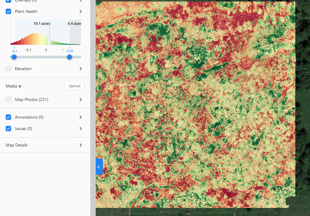
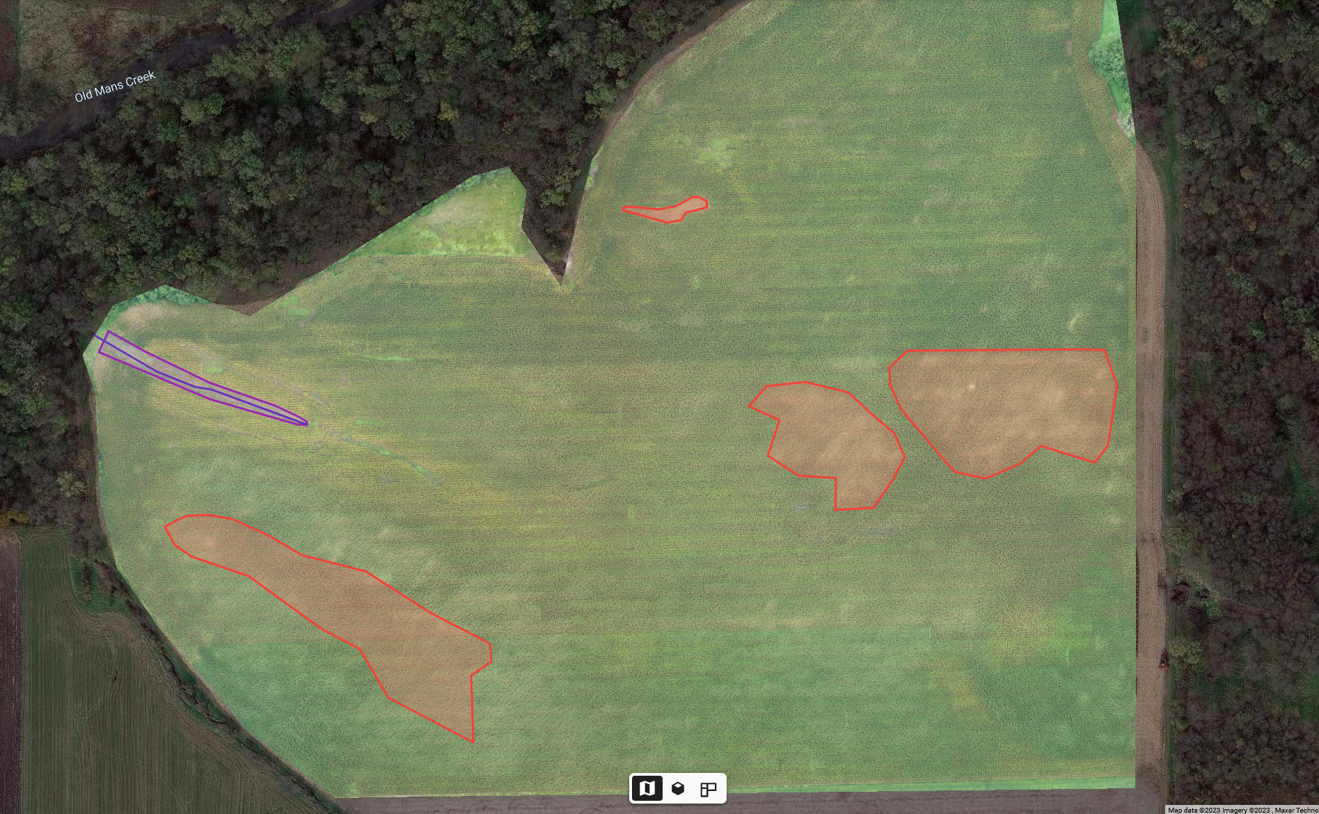
Our drone inspections are also highly effective in agriculture and farming, as they provide a bird’s-eye view of crops and fields, which can be used to assess crop health, yield potential, and irrigation needs. Additionally, our inspections are useful in pipe analysis and other types of inspections, as they provide a non-invasive way to inspect hard-to-reach areas. We use state-of-the-art drone technology and imaging software to capture high-resolution videos and images, which are then analyzed by our experienced team to provide accurate and actionable insights. Our goal is to help our clients save time and money, while also improving safety and reducing risks. If you’re looking for reliable and cost-effective drone inspections, look no further than SkyHawk Drone Solutions. Contact us today to learn more about our services and how we can help you achieve your goals.
Photogrammetry
2D photogrammetry is a technique that uses a series of two-dimensional images to measure and create a digital representation of an object or environment. In this process, images are taken from multiple angles, and software analyzes the perspective and scale of the images to generate accurate measurements and create a 2D model of the subject. This technique is widely used in applications such as aerial mapping, surveillance, and security, as well as in the analysis of crime scenes and accidents. It is a cost-effective and efficient method for creating 2D models, but it does have limitations when it comes to creating complex 3D models or capturing fine details and textures of a subject.
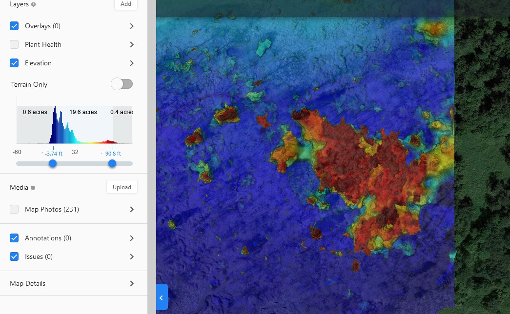
At SKYHAWK Drone Solutions, we use DroneDeploy software to generate our 2D and 3D models that are useful for our customers. DroneDeploy is a cloud-based drone mapping software that allows users to plan, fly, and analyze aerial surveys and inspections using drones. It offers an intuitive and user-friendly interface that simplifies the drone mapping process, making it accessible to a wide range of industries and applications, such as construction, agriculture, mining, and surveying. With DroneDeploy, users can create highly accurate maps, models, and 3D renderings of the area surveyed, as well as conduct analysis and share the data with team members or clients in real-time. The software also offers advanced features such as automated flight planning, cloud processing, and integrations with other industry-specific tools and platforms. Overall, DroneDeploy is a powerful and versatile tool that helps users unlock the full potential of drones for data collection, analysis, and decision-making.